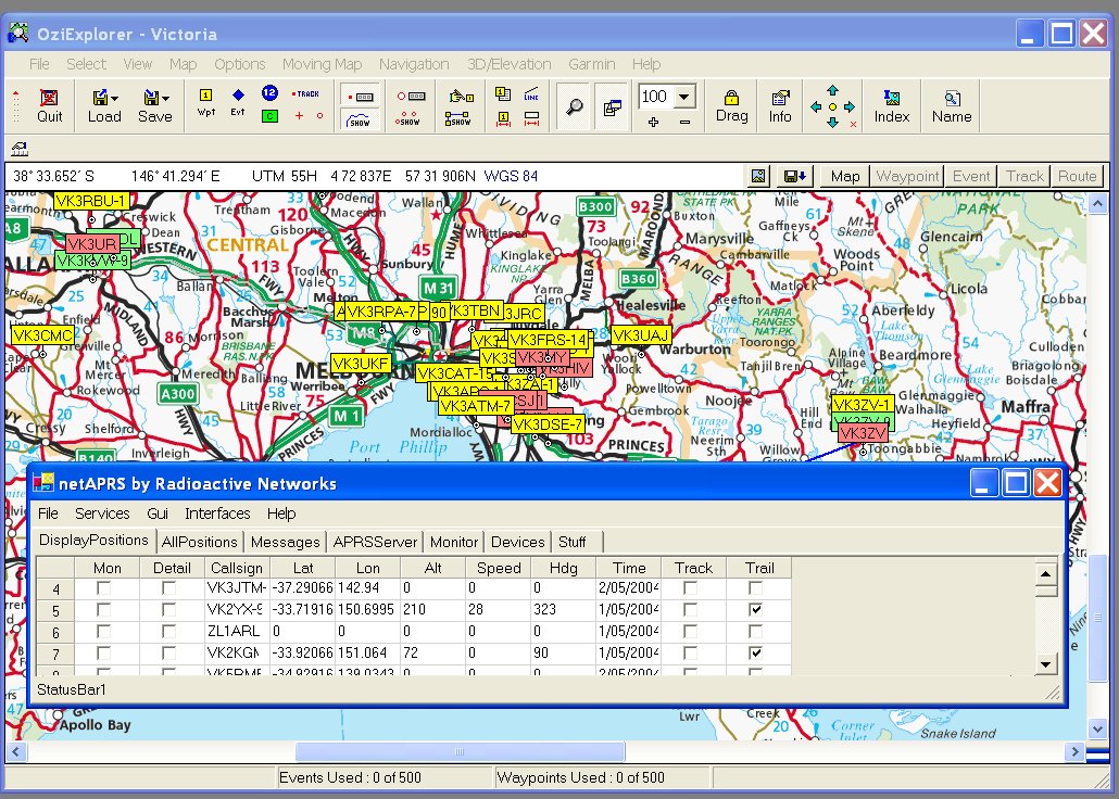
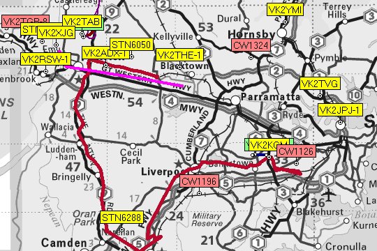
NetAPRS
- Monitor the positions of up to 1000 stations in real time both within a table and on a map.
- Trail up to 70 stations with a ‘Snail Trail’ as they move
- Track the position of one station as it moves, automatically using the best map available as well as drawing a ‘Snail Trail’
- Have station details ‘decay’ as the data becomes less current.
- Display the station positions in
- Microsoft MapPoint (http://www.microsoft.com/mappoint)
- OziExplorer (http://www.oziexplorer.com)
- Microsoft MapPoint (http://www.microsoft.com/mappoint)
- Connect to servers to download positions for display in real time, as well as acting as a server to send positions out in real time.
- Act as a server for
- Radio Modem based Tracking (e.g. Byonics TinyTrak – http://www.byonics.com)
- GPRS based GPS Trackers – such as iGPRS and the M110
- NetGPS PDA based trackers
- Radio Modem based Tracking (e.g. Byonics TinyTrak – http://www.byonics.com)
- Station positions are logged to a database as required. This includes logging all positions, and updating a table of the most up to date positions.
- Positions can be played back from the database, showing the positions of the recorded stations on a map.
- Integration with the other members of the Radioactive Networks tracking product line.
- Separate DISPLAY and STORAGE tables on the screen. Changing the order of the columns in the station list, as well as choosing which columns to display will be easy to do in software. This allows custom versions to be compiled for each client.
- Unified Setup Screen. No longer will you need to wade through a large number of menus in order to configure the software. A setup screen with most configurable paramaters will ease customisation.
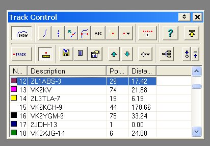
- Track and Trail. In the past OziAPRS could only track one user at a time. netAPRS will keep this limitation, BUT there will also be the ability to create a Snail Trail for another 70 or so users.
- Workgroup WWW Position Serving. netAPRS now includes a light weight WWW server that can be used to provide am XML file containing the latest position reports for all stations all at once.