|
Garmin RINO GPS Specification

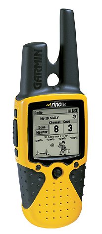 The GARMIN RINO is a combined GPS receiever and radio available for use in
the USA. It only has a short range, limiting it's use. Howevere the on-air
protocol could be used to send data transmitted by these radios onto the
Internet, possably into the APRS data stream. This page is based on the
ideas of Bob WB4APR and others on This Page.
The GARMIN RINO is a combined GPS receiever and radio available for use in
the USA. It only has a short range, limiting it's use. Howevere the on-air
protocol could be used to send data transmitted by these radios onto the
Internet, possably into the APRS data stream. This page is based on the
ideas of Bob WB4APR and others on This Page.
NOTE: All data is transmitted LITTLE ENDIAN. I have assumed that this has
been taken into account when writing this protocol document
Code to Date
I have archived my work to date into a ZIP file. It is all writen in Visual
Basic, and may be downloaded here. The code is without
documentation, but seems to work.
Status
Right now we are waiting on more WAV files of data so that we can analyse
the file format. For each WAV file we need
|
|
 |
Approximate Lat/Lon
|
| |
Approximate Time UTC
|
| |
Symobol, Channel, Code used
|
| |
Any other information you think may be useful |
On Air
On air the data is transmitted at 600 bps. What we have found is that
sampling the received signal at 8 KHz and at 8 bits/sample provides enough
resolution for processing whilst not over-taxing the receiving compluter.
The data is sent so that a transition increasing in voltage is a '0' whilst
a decreasing transition is a '1'. In practice we need to do more work in
order to decode the data. We need to differentiate the incoming signal, not
only removing any DC offset, not only caused by the hardware, but also by
the fact that the data is not scrmbled.
But the differentiation causes a problem within a few samples of the actual
data transition - so we need to stop any data being decoded for about 1/2 a
bit period after a valid transition.
What we have found is that by comparing a sample to the previous sample does
not work as well as we would have expected. What worked better was to
compare to a one sample to the sample before the last one. This also allows
us to increase the threshold for the data detection.
Protocol
|
Position
|
Data
|
|
Bits 0-31
|
Longitude
long lat/lon	- length = 4 bytes, long signed integer encoded as
  11930464.7111111111 * lat/lon in degrees
  The factor as a ratio is 2**30/90.  As a C
  expression, it is ((1L << 30) / 90.0).
  All values are in map datum WGS 84.

  Examples:
	00 00 00 00 = 0x0 = 0.0 deg
	61 0b b6 00 = 0xb60b61 = 1.0 deg
	00 00 00 40 = 0x40000000 = 90.0 deg
	00 00 00 c0 = 0xc0000000 = -90.0 deg
	00 00 00 80 = 0x80000000 = -180.0 deg
|
|
Bits 32-63
|
Latitude
See Latitude.
|
|
Bits 64-71
|
Unknown
|
|
Bits 72-79
|
Symbol?
|
|
Bits 80-139
|
Callsign
Callsigns are in 6-bit bytes, with the LSB transmitted first. The character
set does not use ASCII, but some other standard as Byon N6BG determined. The
offset between the RINO alphabet and the ASCII one is 31 in the case of
characters.
Once corrected for the Little-Endian transmission, we get the following
character set
	0x00	Space
	0x22	A
	0x23	B
	0x3a	Y
	0x3b	Z
|
|
Bits 140-143
|
Unknown
|
|
Bits 144-167
|
Unknown - CRC?
The data may be summed and the low-order 8
bits then negated (2's complement) to form the CheckSum.
|
____
Welcome to our Techical Site. If you are interested in an overview, then visit our
Marketing Site
Copyright © 1994-2005
Radioactive Networks ,
darryl@radio-active.net.au
This page was last updated 2005-09-02 15:16:12
This page was last compiled 2005-11-15 18:52:20
Question or Comment? Click
here
|